Introduction
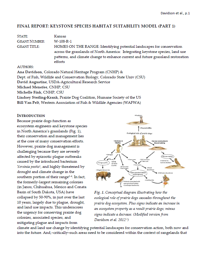
Because prairie dogs function as ecosystem engineers and keystone species in North America’s grasslands (Fig. 1), their conservation and management lies at the core of many conservation efforts. However, prairie dog management is challenging because they are severely affected by epizootic plague outbreaks caused by the introduced bacterium Yersinia pestis1, and highly threatened by drought and climate change in the southern portion of their range2–4. In fact, the formerly-largest remaining colonies (in Janos, Chihuahua, Mexico and Conata Basin of South Dakota, USA) have collapsed by 50-90%, in just over the last 10 years, largely due to plague, drought, and land use impacts. This underscores the urgency for conserving prairie dog colonies, associated species, and mitigating plague and impacts from climate and land use change by identifying potential landscapes for conservation action, both now and into the future. And,–critically–such areas need to be considered within the context of rangelands that are relied on for cattle production and have traditionally harbored complex social cultures resistant to prairie dog conservation.
The capacity for a landscape to support spatially extensive grassland conservation efforts depends on a complex suite of abiotic, ecological, social, and economic factors. Mapping of landscape capacity to support such conservation efforts in the central Great Plains can provide a much-needed tool for optimizing use of scarce funds for grassland conservation and restoration efforts. This is especially valuable for contemporary management because of the social, environmental, and economic factors that influence where prairie dog complexes can be conserved and expanded across large blocks of continuous habitat – to support numerous grassland species.
To address this need, we are working to identify potential landscapes for conservation, through spatial modeling. Our work is examining ecological, political, and social factors, along with changing climate and land use to maximize long-term conservation potential and co-existence with human activities. Our project involves two major components: Part I, developing a black-tailed prairie dog habitat suitability model (HSM) under both current climate and projected future climate scenarios (Fig. 2) and Part II, identifying suitable landscapes for black-tailed prairie dog (BTPD) ecosystem conservation using the conservation planning tool, Zonation. Here we provide the Final Report for the BTPD HSM (Part I) (Fig. 2).
Attached Files
- Version:
- File Type: pdf
- Size: 0.00 KB
